

Cyril Radcliffe lands in Delhi on July 8th, 1947.
He is 48 years old. He is a lawyer - a good one, by all accounts, respected in London legal circles, comfortable with complex briefs and competing arguments. He has handled difficult cases. He has managed large commissions. He has, by the standards of his profession, seen a great deal.
He has never been to India. He does not speak any of its languages. And most importantly - he has never drawn a border in his life.
None of this disqualifies him. In fact, it is precisely why he was chosen. Lord Mountbatten - the last Viceroy of British India, tasked with engineering independence before the end of the year - needed someone who could be presented as neutral. Someone with no prior allegiances, no existing relationships with either side, no investments in the outcome. Someone who could sit at a table between Hindus and Muslims and be seen as neither.
Radcliffe was neutral because he knew nothing.
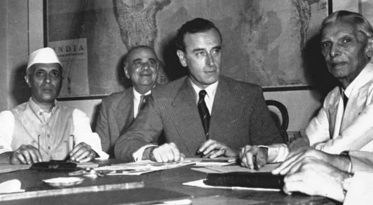
He steps off the plane into the Indian summer and later describes it as a foretaste of the mouth of hell. He is taken to a bungalow in Delhi where the maps are waiting.
The maps are out of date. The census data is from 1941. The subcontinent he is being asked to divide has changed enormously in six years - populations have shifted, villages have grown, rivers have moved. He has been given five weeks to make decisions that will affect the lives of 400 million people, redraw the boundaries of two new nations, and determine which communities live on which side of a line that, once drawn, will be enforced by soldiers.
Five weeks. Bad maps. No ground knowledge. And on either side of him, representatives of the Indian National Congress and the Muslim League, each of whom has spent years fighting over every river, every district, every irrigation canal - and none of whom will agree on anything.
The decisions, in the end, will fall to Radcliffe alone.
THE DECISION
Here is what Radcliffe faces:
He must divide Punjab in the west and Bengal in the east - two of the most densely populated, religiously mixed, economically complex regions in the world. The principle is simple: Muslim-majority areas go to Pakistan, Hindu and Sikh-majority areas go to India. The reality is that no line drawn on any map will cleanly separate communities that have lived intermingled for centuries.
Villages are split down the middle. Irrigation canals that feed one community’s crops run through another community’s land. Sikh holy sites sit in Muslim-majority districts. Entire cities - Lahore, Amritsar - sit so close to the proposed line that the drawing of it one way or another will determine whether millions of people become citizens of a country they have never wanted.
Here is what Radcliffe doesn’t know - can’t know, from his bungalow in Delhi with his outdated maps:
That the violence has already started. That in the villages of Punjab, communities that have lived side by side for generations are already turning on each other in anticipation of where the line will fall. That every day he spends deliberating, more people are dying.
Here is what makes it worse:
Mountbatten has moved the deadline. India and Pakistan will become independent nations on August 15th. The line will be announced two days later - after the independence ceremonies, after the celebrations, after the flags have gone up and the speeches have been made. The people living along the border will not know which country they belong to until after their country has already been declared.
Radcliffe works in his bungalow. He studies the maps. He makes his marks.
Later, he will say: “I had no alternative. The time was too short.”
July 1947, Delhi. You have five weeks, bad maps, and the lives of 400 million people. You cannot satisfy both sides. You cannot even properly see the ground you are dividing.
Where do you draw the line?
WHAT HAPPENED
On August 17th, 1947 - two days after India’s independence, three days after Pakistan’s - the Radcliffe Line is published.
The announcement triggers one of the greatest humanitarian catastrophes in modern history.
Between 12 and 14 million people begin moving - Hindus and Sikhs fleeing west to east, Muslims fleeing east to west, entire populations uprooted overnight. At its peak, 40,000 people per day are on the move. Trains that set out full arrive empty - passengers massacred mid-journey, the carriages delivered as messages. Villages are burned. Women are abducted. Communities that had coexisted for generations destroy each other in weeks.
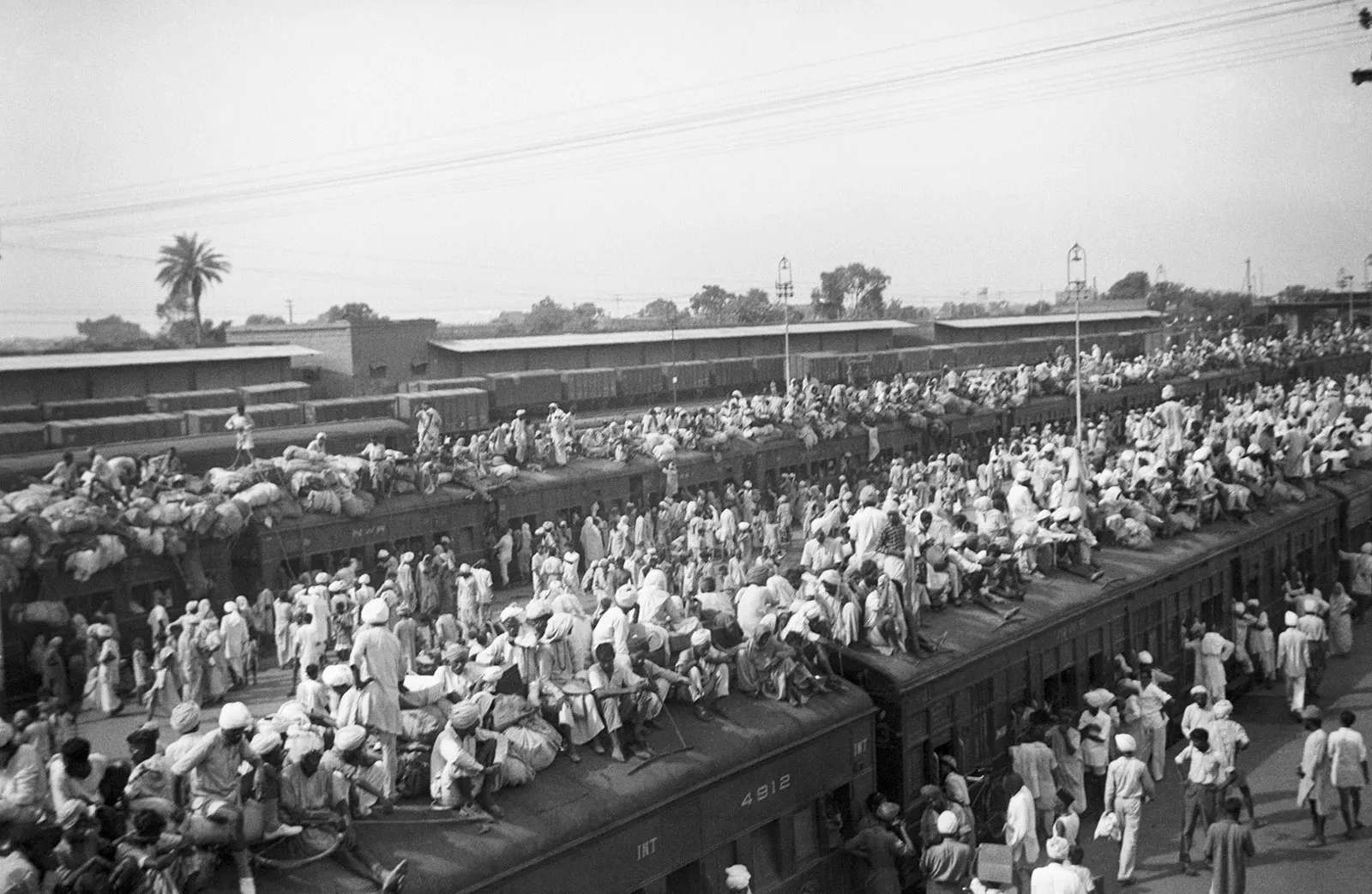
Between 200,000 and 2,000,000 people die. The range of the estimate is itself a measure of the chaos - so many people, dying so fast, in so many places, that no one could count them all.
Radcliffe leaves India on August 17th - the same day the line is published. He will never return.
Back in London, he refuses his fee. He burns every paper, every note, every map he worked from. Then he writes the line that explains everything:
“There will be roughly eighty million people with a grievance who will begin looking for me. I do not want them to find me.”
A year later, the British government awards him a knighthood. He accepts it. Nobody who lived through the partition is recorded as having been consulted on whether this was appropriate.
The Radcliffe Line still exists. It is still, today, one of the most militarized borders on earth. The Kashmir dispute it helped create has produced three wars and remains unresolved. The line that one man drew in five weeks, in a bungalow in Delhi, with bad maps and no ground knowledge, has shaped every year of the 77 years that have followed.
DIG DEEPER
The line was announced after independence on purpose. Mountbatten made the decision to delay publishing the Radcliffe Line until after the independence ceremonies. His reasoning: announcing it beforehand would trigger violence that would overshadow the celebrations. The result was that millions of people celebrated independence without knowing which country they were in - and woke up the next morning to find the answer was not what they had assumed.
One commission member asked if Darjeeling could go to Pakistan. Radcliffe later recounted that a Muslim member of the Bengal commission asked him to include Darjeeling - a hill station beloved by the Bengali elite - in Pakistan, because his family spent summers there. Radcliffe declined. The exchange captures the full absurdity of what he was being asked to do: divide a subcontinent in five weeks, while commission members lobbied for their holiday destinations.
Radcliffe never spoke publicly about the partition in detail. He gave almost no interviews. He destroyed his working papers. When pressed in his later years about the decisions he had made, he consistently deflected. He died in 1977, having spent three decades saying almost nothing about the five weeks that defined his entire legacy - and the lives of hundreds of millions of people.
Good one. The tragedy of the region can be told in 3 lines, drawn by 3 people .... Radcliffe Line, Durand Line and McMahon Line. They were lines on maps to serve the British colonial interests and whims driven by ignorance and bigotry, but the repercussions are being felt even today by millions
Good article capturing the person who was given work of taking decisions that will affect millions . A few subtleties are given in Shattered Lands by @Samdalrymple . But even then great work keep it up .